Central CRA Boundary Map
The Central City CRA is a 344 acre community redevelopment area established under Chapter 163 Florida Statutes and is generally bounded by NE 13th Street and NE 16th Street on the North, Sunrise Boulevard on the south, Power line Road and I-95 on the west and the Florida East Coast railway on the east.
Boundary Map
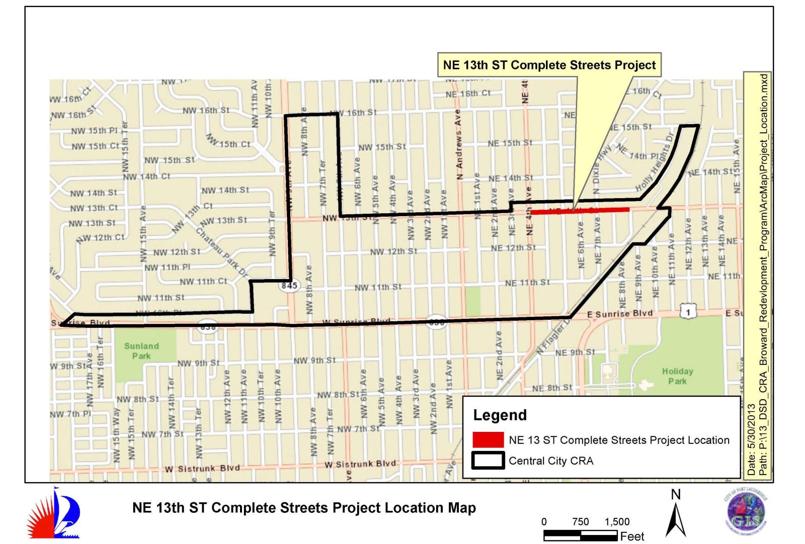
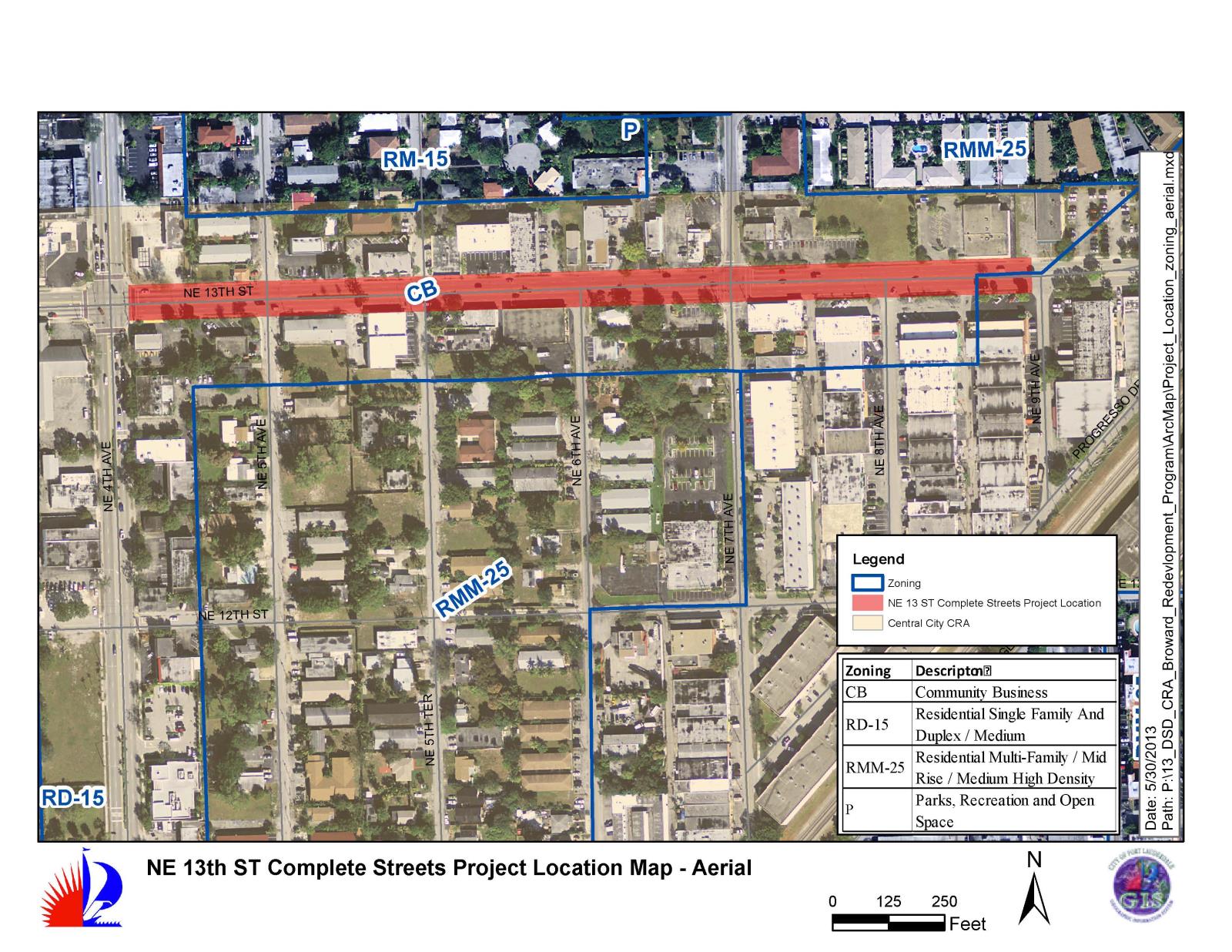
NE 13th Street Complete Streets Project Location Map
Central City CRA Contact Information
Cija Omengebar, FRA-RP | CRA Planner
City of Fort Lauderdale | Community Redevelopment Agency
Central City CRA
914 Sistrunk Boulevard, Suite 200
Fort Lauderdale, FL 33311
Tel: 954-828-4776
Fax: 954-828-4500
comengebar@fortlauderdale.gov