Property Zoning and Land Use Information
3D Interactive Zoning Map and Code Information
The City of Fort Lauderdale, in conjunction with Gridics, LLC, has launched a comprehensive zoning code platform. The applications within the platform include an interactive 3D Zoning Map, the City’s Unified Land Development Regulations (ULDR) Code, and a Parcel Zoning Check to look up zoning and property data. The applications will help staff and neighbors with planning and zoning inquiries by enabling you to:
- View 3D models of development projects submitted to Development Review Committee (DRC), including review and approval status;
- Access parcel information and zoning regulations throughout the City of Fort Lauderdale;
- Access the City’s Code allowing users to bookmark, highlight, and use notation features;
- Allow staff to view citywide development and visualize 3D development scenarios/ evaluate changes in the City’s built environment;
You can view a tutorial video of how to navigate the 3D application map.
Regional Activity Center (RAC) Development Projects
Downtown
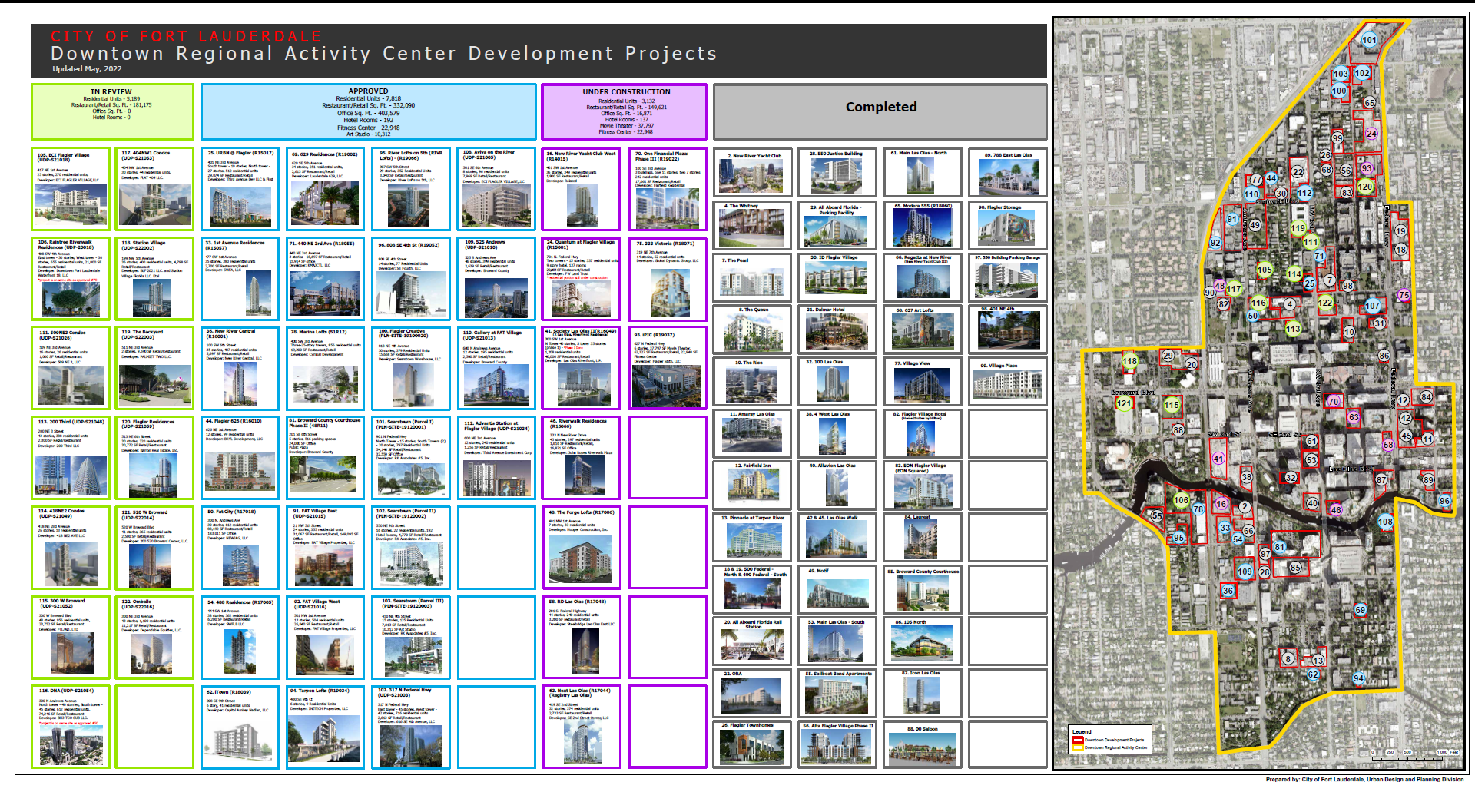 (PDF, 2MB)
Central Beach
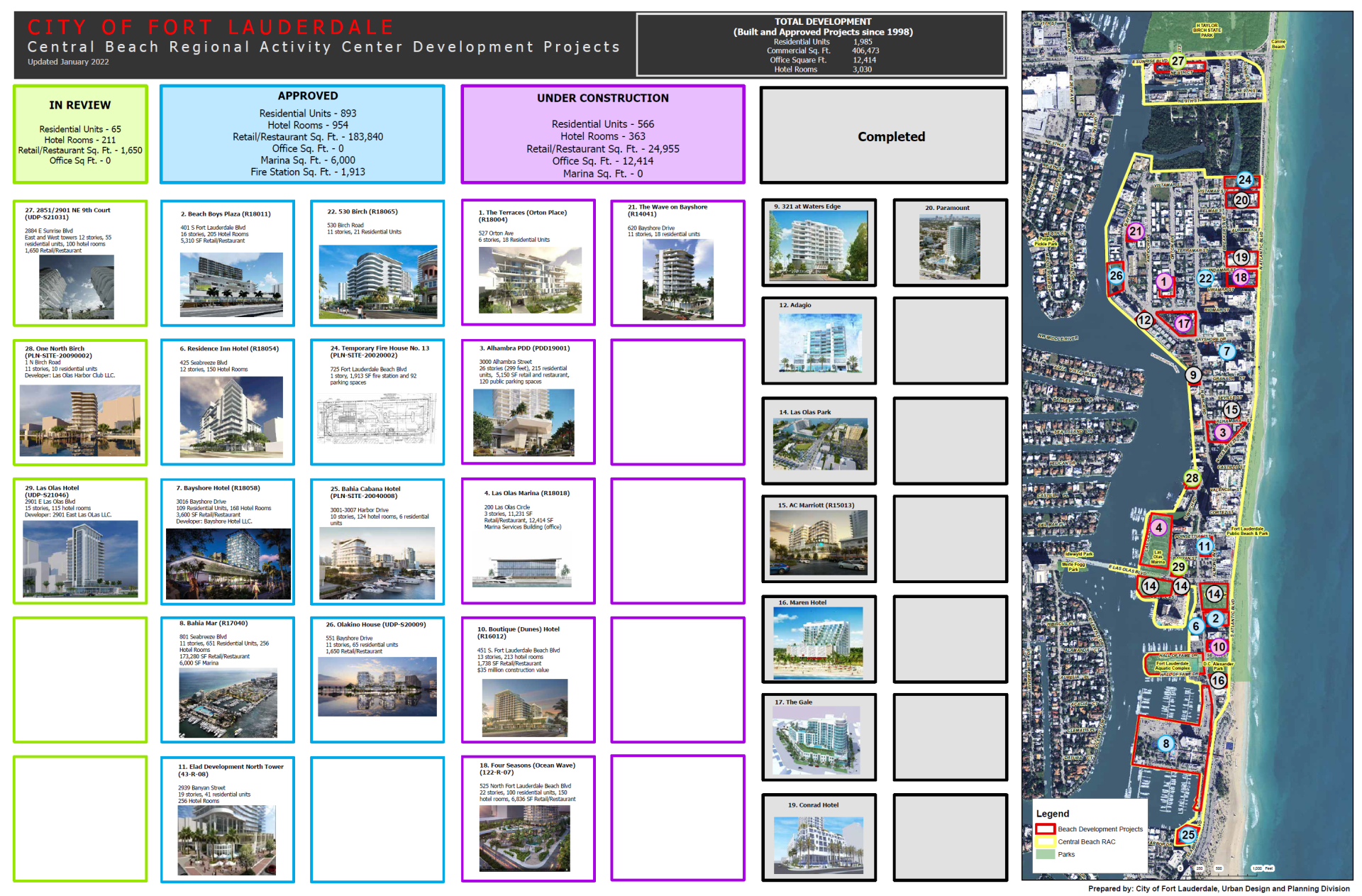 (PDF, 939KB)
Northwest RAC
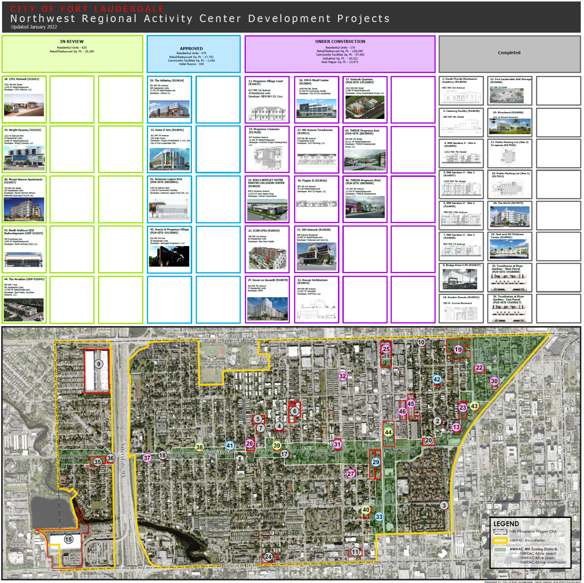 (PDF, 3MB)
Uptown
 (PDF, 500KB)
Additional Resources